More than one-third (38%) of human settlements in the Amazon were highly exposed to the effects of the 2024 El Niño, according to a study released Friday (Sep. 4) by MapBiomas – a network formed by universities, NGOs, and technology companies. Among the 5,673 inhabited areas in the region, 2,172 suffered severely from the phenomenon.


El Niño is characterized by the warming of the surface waters of the Tropical Pacific Ocean and causes changes in atmospheric circulation, leading to irregular rainfall patterns. In the Amazon, it causes drought and rising temperatures.
Notícias relacionadas:
In light of the weather forecast predicting that the phenomenon will be particularly strong this year – “Super El Niño” – researchers cross-referenced data on rainfall and land surface water to show how the Amazon was affected during the last occurrence of this climate event.
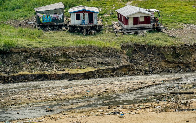
From September through November 2024, the water surface area in the Amazon was 1.9 million hectares below the historical average for the years 1985 through 2025. Rainfall was also lower, at 27 percent below average.
The average maximum temperature during those three months also rose significantly, reaching 2.6 °C above the historical average for the same period.
“Less rainfall and higher temperatures increase evaporative demand in the atmosphere, contributing to soil moisture loss and water stress in vegetation,” said Bruno Ferreira, a researcher at the Amazon Institute of People and the Environment (Imazon) and a member of the MapBiomas Amazon team.
From September through November 2024, the water surface area in the Amazon was 1.9 million hectares below the historical average for the years 1985 through 2025 - Rafa Neddermeyer/Agência Brasil
Population
The study also examined the effects of the phenomenon on different types of human settlements – such as urban and rural areas, indigenous territories, quilombola communities, settlements, and other categories.
The population in these areas are said to have been severely affected by El Niño, as 93 percent of the locations surveyed – 5,273 in total – are within 5 km of areas that experienced a reduction in water surface area, the study notes.
“The drought also manifests itself in lower river levels, with consequences for transportation, access to water, fishing, and other activities that depend on river systems,” Bruno Ferreira noted.
Land cover and land use data complement the biome exposure factors, since over the 41-year historical time series of the study on this topic, 3.9 million hectares of native vegetation were lost, which is equivalent to a 14 percent reduction in the previously existing green cover.
In the study, the experts cross-referenced data on land cover and land use, water, and the atmosphere. They also used data from the statistics bureau IBGE on inhabited areas and information from the El Niño Panel of Brazil’s National Institute of Meteorology (Inmet).

 Войти
Войти